Back to Terrain Module
Most road design software support standard projections like UTM out of the box. Custom local projections may not be recognized by other software or may cause alignment issues unless manually configured.
Transforming Local Coordinate System to UTM Projection in RoadEng
Updated June 18, 2025
This article applies to:
- Terrain 3D
- Terrain Forestry
- RoadEng Civil
Most road design software support standard projections like UTM out of the box. Custom local projections may not be recognized by other software or may cause alignment issues unless manually configured.
Additionally, larger companies and organizations with multidisciplinary projects benefit from using standard EPSG codes like UTM, as this ensures consistency across teams - including survey, design, environmental, and construction, especially, when coordinating across platforms.
To support this consistency, users may need to transform projects using custom local projections to Universe Traverse Mercator (UTM).
Step 1: Open your Terrain File.
-
Launch RoadEng - Terrain Module and open the terrain file you want to modify.
Step 2: Select All Features
-
Go to Home tab.
-
Click on Select > All Features, or press Ctrl + A to select all the features in the file.
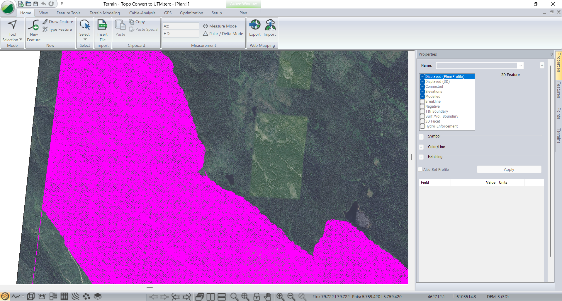
Figure 1: All features selected in Plan Window.
Step 3: Apply the Coordinate Transformation
-
Select the Feature Tools ribbon and press Transform.
-
A warning or confirmation message may appear — accept any prompts to proceed.
-
The Coordinate Transformation dialog will appear.
Step 4: Choose the Coordinate Systems
-
In the transformation dialog:
-
Set the source projection to match the current coordinate system of your data.
-
Set the tarjet projection to the desired coordinate system for your project.
-
-
Click OK and then Apply the transformation.
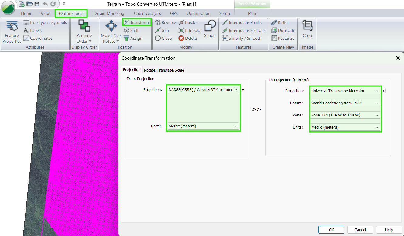
Figure 2: Coordinate Transformation dialog.
Step 5: Confirm the Results
-
Use the Live Map tool to visually confirm that the data appears in the correct geographic location.
-
This step helps ensure the transformation was successful.
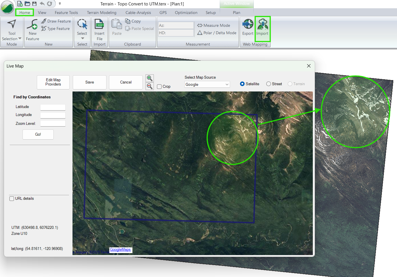
Figure 3: Live Maps to confirm the correct projection.
Step 6: Update Your Surface and Save
-
Regenerate the TIN Surface if needed.
-
Save your updated Terrain file to retain the new coordinate system.
Note: After transformation, associated files (such as Location .dsnx files) will automatically inherit the new projection, as it depend on the referenced Terrain topo.