Exporting a Terrain File (*.terx) to Civil 3D (DWG/DXF)
Updated April 22, 2025
This article applies to:
- Terrain 3D
- Terrain Forestry
- RoadEng Civil
- RoadEng Forestry
Both Terrain and Location can generate 3D files but they are not in DWG format by default.
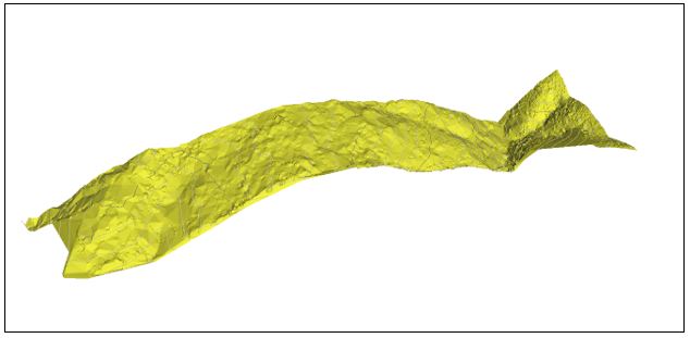
This is a 3D view of a TIN surface generated in Terrain.
To save your file in AutoCAD/Civil 3D format:
1. Click on ![]() | Save As, then change the file type to *.dwg (see below).
| Save As, then change the file type to *.dwg (see below).

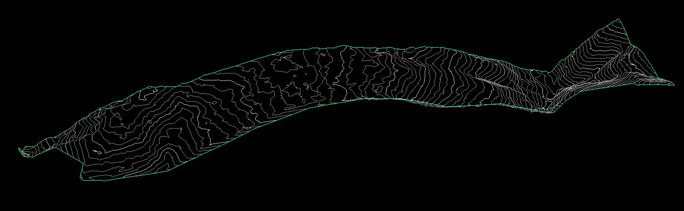
Here the DWG just contains points, linework and labels.
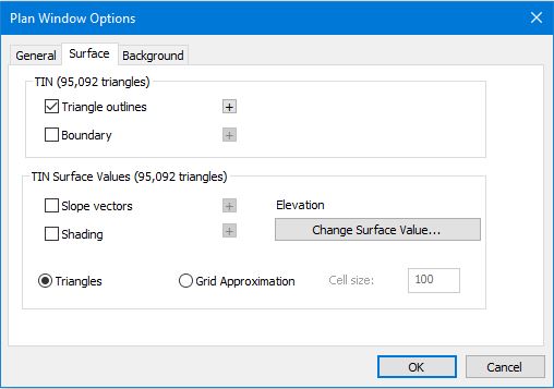
Note 1: When exporting a TIN to DWG/DXF (from Terrain), "Triangle outlines" needs to be checked to generate a 3D view in Civil 3D.
Right-click on Plan View | Active Window (Plan) Options... | Surface | Triangle outlines
2. After naming the file as desired, you will be brought to “export DWG/DXF options dialogue box.

Check Allow 3D Points & Polylines and Plan.
This is the 3D view in Civil 3D:

To export TIN surfaces it is more convenient to use the LandXML format. This gives you the actual 3D surface that was created in Terrain or Location.
To save a file as LandXML:
Click on ![]() | Save As, change the file type to Landxml (*.xml).
| Save As, change the file type to Landxml (*.xml).
Note 2: the option Triangle outlines does not need to be checked in Terrain.
To open the file in Civil 3D:
File | New
File | Import | Import LandXML