Exporting to Avenza and to JPEG Worldfiles
Updated August 05, 2025
This article applies to:
- Terrain 3D
- Terrain Forestry
Exporting to a JPEG Worldfile (JGW) is an auxiliary file used to georeference JPEG images within a Geographic Information System (GIS).
To export georeferenced background ortho images from Terrain Module to other software, you can use Screen Capture (.jpg) or Avenza (.zip) formats.
To do so, you can go to File I Save As I and use the Save as type drop-down list to select Screen Capture (.jpg) (see Figure 1).
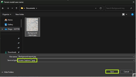
Figure 1: Save As Screen Capture format.
This process will generate two files with the same name, one in .jpg format (the image) and one in .jgw format (the georeferencing file), as shown in Figure 2 below.
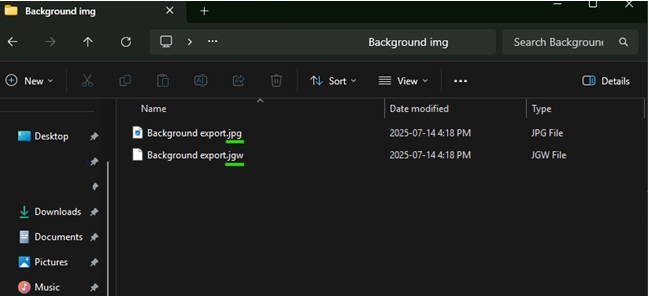
Figure 2: JPG and JGW Exported Files.
In the software you'll use for importing, you can add the image as a JPG file, and the associated JGW file will automatically provide the georeferencing information.
Alternativately, you can also export as Avenza file (.zip). This type of export will generate a file in three (3) different formats. JPG (image), JGW (referencing file) and PRJ (projecting file).