Hydrology Tools
Updated September 29, 2022
This article applies to:
- Terrain 3D
- Terrain Forestry
- RoadEng Civil
- RoadEng Forestry
Terrain module (as of Version 10) contains a hydrology tools dialogue that will allow you to carry out several hydrological operations including Catchment, Drainage and Streams and Ponds.
All operations are based on a regular grid. The cell size of the regular grid is user controlled
Create Watershed Features
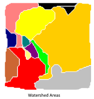
This operation determines the catchment areas of the TIN model and creates corresponding features.
A catchment area (watershed or drainage basin) is defined as an area of land where precipitation collects and drains off into a common outlet, such as into a river, bay.


The automatic calculation of watershed areas is based on a regular grid. The user can choose the grid Cell Size.

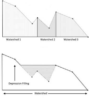
Depression Fill Depth parameter is used to smooth the surface by filling minor depressions.
 Remove Selected Features if checked, existing watershed features will be removed before the new ones are added.
Allow flow to outside is checked, flow along the model boundary will be prevented.
Create Drainage Area Feature
This operation determines the drainage area associated with a specific x,y point creates corresponding feature.


Depression Fill Depth parameter is used to smooth the surface by filling minor depressions. See description above.
Drain Location parameter specifies the x,y position of the drain.
Drain Radius parameter specifies a radius about the drain point into which water may flow.
Remove Selected Features if checked, existing watershed features will be removed before the new ones are added.
Create Stream and Pond Features
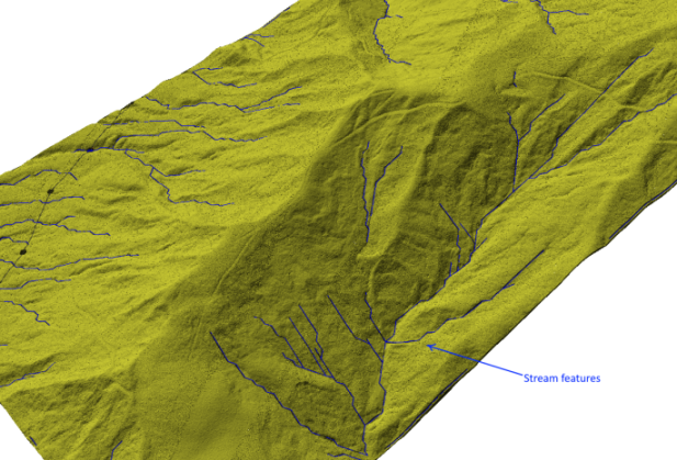
This operation creates stream and pond features.


Stream Drainage Area parameter determines which cells will be considered to be part of a stream network. For example if the defined Stream Drainage Area is 9000sq.m.; for any cell to be a part of a stream, at least 9000sq.m. of water should flow into that cell. Changing this parameter has direct affect on the length and density of the streams.
Depression Fill Depth parameter is used to smooth the surface by filling minor depressions. See description above.
Remove Selected Features if checked, existing watershed features will be removed before the new ones are added.
Allow flow to outside is checked, flow along the model boundary will be prevented.