Setting Absolute Coordinates in the Traverse Document
Updated July 08, 2021
This article applies to:
- Terrain 3D
- Terrain Forestry
- RoadEng Civil
- RoadEng Forestry
This Knowledge Base article is an excerpt from one of our tutorial files. The files referenced in the article, as well as the full tutorial document, are available in our Tutorial Installer.
 File | Open <SurveyMap>\Adjust\method1.map.
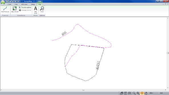
There are two traverses in this map, main.tr1 and block1.tr1; see figure below.

Figure 1: Method1.map Before Adjustments
Double-click on each traverse (one at a time) in the Map Window to open the corresponding traverse document. The selected traverse will turn magenta. Select View |Tile Vertically after opening each traverse document to arrange the windows.
Click on the BLOCK1.tr1 title bar. From menu View | Tile Vertically button.
This screen layout displays stations, corresponding labels and XYZ coordinates.
In this example, Block1 will be adjusted with respect to Main because Main is more accurate.
Highlight MAIN.tr1. Scroll to find POC block1 in the Label column (station 699.1). Note the X, Y, and Z coordinates (this is the “Point of Commencement” of block1).
Highlight BLOCK1.tr1, and select Station 0.0.
From menu Traverse | Set/Get XYZ Coordinates, change Station 0.0 coordinates of BLOCK1.tr1 to the same coordinates at MAIN.tr1 station 699.1 Type 114.9 for X, 294.2 for Y and 193.0 for Z. Press OK.
Close BLOCK1 by selecting Traverse | Close Traverse button. Press OK to confirm closing of the traverse.
Alternatively, to close the Block1 traverse, you could have scrolled to the last station (898.0) in BLOCK1.tr1. Selected Coordinates | Set/Get XYZ Coordinates. Turned on XY Absolute and Z Absolute and changed the coordinates to equal those of station 0.0. (X= 114.9, Y= 294.2 and Z= 193.0)
Note: In addition to opening the Coordinate box by selecting Traverse | Set/Get XYZ Coordinates the Coordinate box can also be opened by left clicking in the x, y, or z field.
A Coordinate Adjust Log dialogue box appears, indicating the deviation to Absolute station 898.00, area of the closed traverse of 5.6Ha and a closure error of 0.74%. Press OK.
Find label “block 681.5” (station 502.1) in the Label column of MAIN.tr1. Make note of the coordinates (286.8, 201.4 and 174.9). This corresponds to station 681.5 in BLOCK1.tr1.
Highlight BLOCK1.tr1. Scroll to find “main 502.1” in the label column (Station 681.5).
Choose Traverse | Set/Get XYZ Coordinates, turn on XY Absolute and Z Absolute and change the coordinates to equal those of Station 502.1 in MAIN.tr1. Type 286.8 for X, 201.4 for Y, 174.9 for Z. Press OK
A Coordinate Adjust Log dialogue box appears as shown below. It lists the (XY) and (Z) adjustments, area of the closed traverse and a closing error.
Press OK.

Figure 2: Coordinate Adjust Log
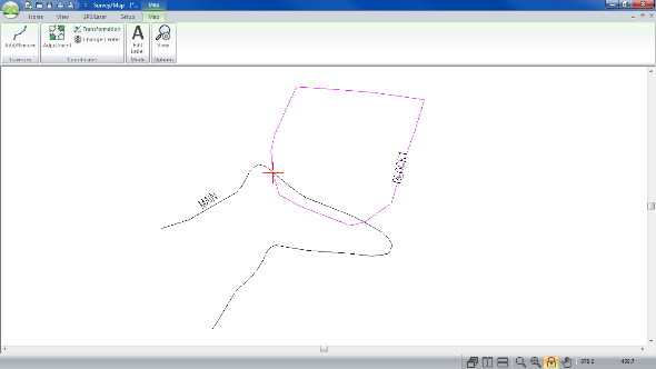
BLOCK1.tr1 is now closed and adjusted to match the two stations intersecting MAIN.tr1. The figure below shows method1.map before and after the final adjustments.
 |
 |
Figure 3: Method1.map Before (left) and After (right) Final Adjustment
 File | Close both the Traverse and Map Documents. Do not save the changes.