Back to Location Module
Switching Topo Terrain Files
Updated April 02, 2024
This article applies to:
- RoadEng Civil
- RoadEng Forestry
Occasionally, when modifications have been made to survey data or Terrain files, it becomes necessary to interchange the Terrain file utilized as the Reference Surface in the Location file under current development.
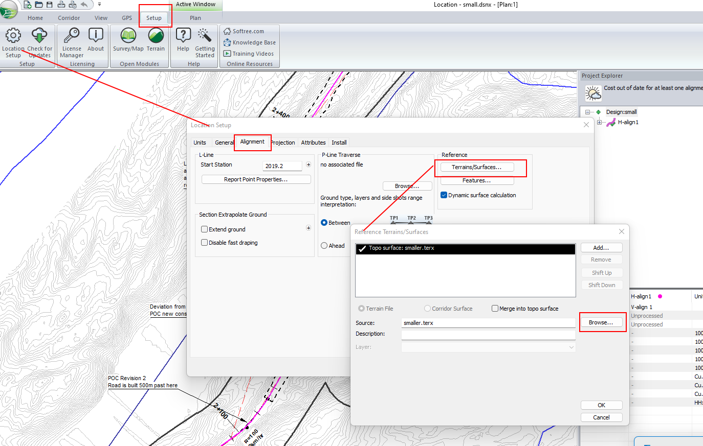
To switch the Terrain file in Location, you can follow the steps below:
1. Setup ribbon tab | Location Setup
2. Select the Alignment tab from the Location setup dialogue
3. Under Reference, select Terrains/Surfaces button.
4. Press the Browse... button to find your new Terrain file.
5. Press OK twice to accept the changes.

Figure 1. Workflow to switch Topo file in Location.