Calculate Disturbed Area
Updated February 14, 2025
This article applies to:
- RoadEng Civil
- RoadEng Forestry
The area where vegetation, topsoil, or overburden is removed is commonly known as Disturbed Area.
METHOD 1
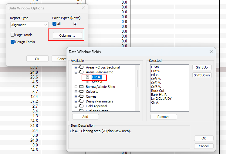
In RoadEng, It is possible to display the ‘Disturbed Area’ in the Data Window. To do this, create a New Data Window, by right-clicking open Data Options..., then press Columns... button and select Clr. A.in the Data Window (see Figure 1).

Figure 1. Clearing area selected in Data Window Fields
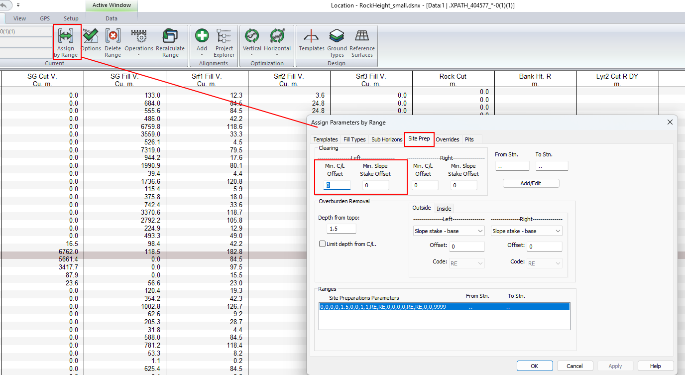
To use this method, ensure to set the Site Prep Clearing parameters as follows:
In Corridor ribbon, press Assign by Range button and select Site Prep. tab.
In Clearing range set (see Figure 2.):
- Min C/L Offset = 0
- Min Slope Stake offset = 0

Figure 2. Clearing seetings in Assign Parameters by Range dialog.
METHOD 2
Another method to calculate the Disturbed area is to Export the Slope stake line from a Design file to a Terrain file.
Press File l Save As and use the Save As Type drop-down list to select Softree Terrain (*.terx), then hit Save.
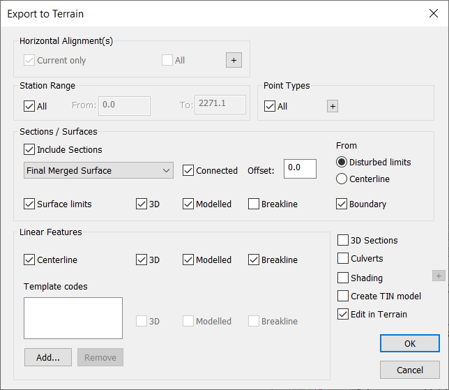
Use the following settings (Figure 3.) and press OK to export generating a Terrain document.

Figure 3. Export To Terrain Dialog.
You'll be prompted with a new Terrain file as follows.

Figure 4. Disturbed Area Polygon
Then, selecting the feature, the area of the polygon will be displayed in the Status window (see Figure 5).
Figure 5. Status Window displaying the Disturbed Area.
Lastly, to display the Area in different units use the Status Options..., Add/Remove button and browse to select the desired units. e.g. Square Units, then press OK twice to apply changes.

Figure 6. Display Area in Square meters.
Note: You can change the document Units (e.g. from Metric to Imperial) in Setup - Module Setup Menu.